

Baker Draw Designated Shooting Area

Temporary closure expected August 16 from 7:30 a.m. until noon for weeds treatments.
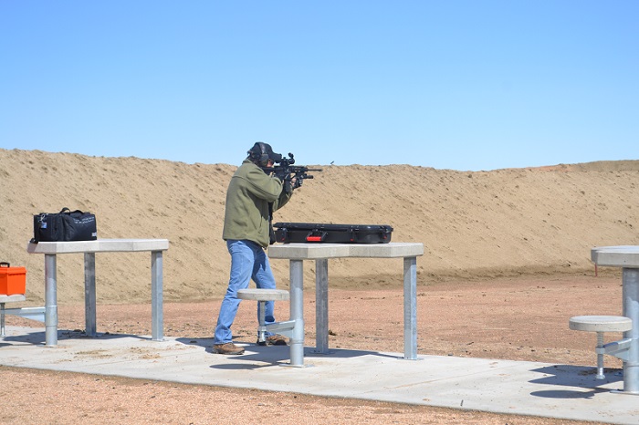
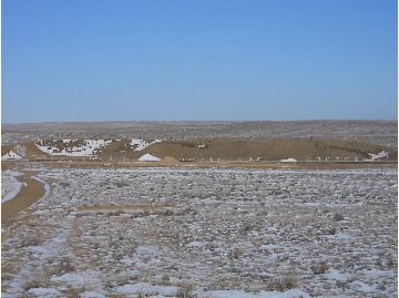
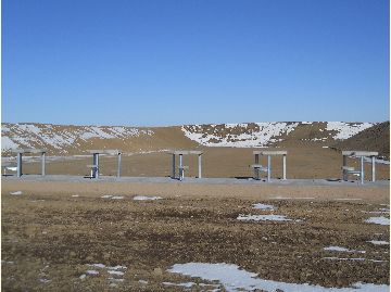
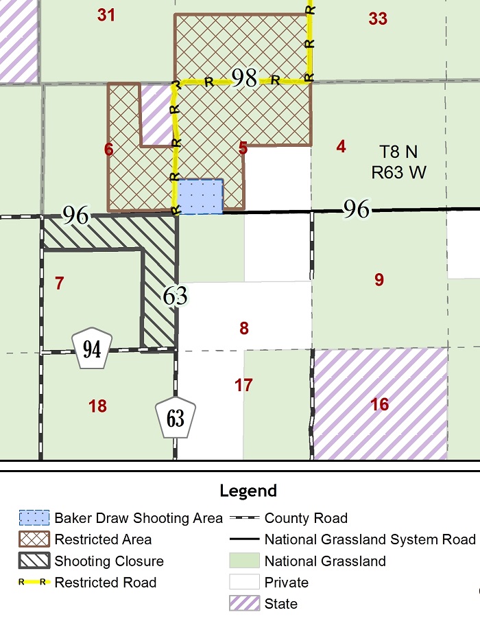
The Baker Draw Designated Shooting Area is located near the intersections of Weld County Roads 96 and 63. It has dirt berms providing 25-, 50- and 100-yard shooting opportunities.
- 100 yard lanes: Rifles only with targets at 50 yards and 100 yards only
- 50 yard lanes: Hand guns and rifles only with targets at 25 yards and 50 yards only
- 25 yard lanes: Hand guns only, with targets at 7, 15, or 25 yards only
*Target height should be 4ft. minimum to prevent ricochets.
Amenities:
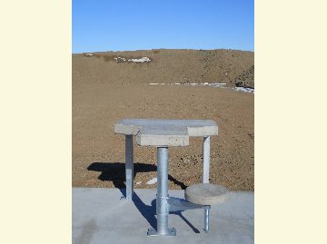
The site includes a parking area, informational kiosk, restroom facilities, and 30 shooting lanes with 26 benches and shade structures. No trash facilities are on site. Pack it in; Pack it out!
Baker Draw Area Rules & Regulations
- No clay pigeons allowed.
- Rifles and hand guns only. No shotguns as of June 1, 2016.
- Alcohol is not permitted.
- Firearms shall only be discharged from designated shooting stations.
- No tracer rounds or incendiary rounds allowed. No exploding targets.
- Shoot only at authorized targets. This is limited to paper, cardboard or manufactured metallic targets at Baker Draw.
- Wood backing not allowed; however, wooden frames are.
- Ensure weapons are unloaded or holstered when moving them between vehicles and the firing line.
- Eye and ear protection must be worn at all times while shooting/observing.
- No automatic fire or simulated automatic fire "bump firing."
- No pets allowed.
- Remove all shell casings, target debris, trash, etc.—Pack it in; Pack it out! Area around the site is closed to shooting to enhance safety. See area shooting closure map.
Federal, regional and local shooting restrictions apply.
Safety Information
Users must respect all signs and use the appropriate lane for the firearm they are shooting. Handguns only in the 25-yard lane; rifles and handguns (no closer than 25-yards) in the 50-yard lane; and rifles only in the 100-yard lane.
Read all instructional signs at the shooting area.
Please respect other users.
Partners: This site was made possible by grants from Colorado Parks & Wildlife and the National Rifle Association. Other critical support was provided by Weld County, Chesapeake Energy, Anadarko, Noble Energy, and the U.S. Army Reserves.
| Title: | Baker Draw Designated Shooting Area |
|---|---|
| Date: | December 2013 |
| Forest Name: | Pawnee National Grassland |
| Location: | Baker Draw Designated Shooting Area |
| Credit: | |
| Description: | |
| Source: |
| Title: | Baker Draw Firing Line |
|---|---|
| Date: | December 2013 |
| Forest Name: | Pawnee National Grassland |
| Location: | Baker Draw Designated Shooting Area |
| Credit: | |
| Description: | |
| Source: |

| Title: | Baker Draw Firing Line 2 |
|---|---|
| Date: | December 2013 |
| Forest Name: | Pawnee National Grassland |
| Location: | Baker Draw Designated Shooting Area |
| Credit: | |
| Description: | |
| Source: |

| Title: | Baker Draw 50-Yard Firing Line |
|---|---|
| Date: | December 2013 |
| Forest Name: | Pawnee National Grassland |
| Location: | Baker Draw Designated Shooting Area |
| Credit: | |
| Description: | |
| Source: |
| Title: | Baker Draw Shooting Bech |
|---|---|
| Date: | |
| Forest Name: | Pawnee National Grassland |
| Location: | Baker Draw Designated Shooting Area |
| Credit: | |
| Description: | |
| Source: |
At a Glance
| Operational Hours: | Area open seven days a week, dawn to dusk or as otherwise posted. Occasional closures for clean-up and maintenance expected. |
|---|---|
| Reservations: | Reservations not available. |
| Area Amenities: | Toilets,Parking |
| Fees | No fee |
| Usage: | Medium |
| Busiest Season: | Spring, summer, and fall. |
| Restrictions: |
|
| Closest Towns: | Ault, Colorado |
| Water: | No |
| Restroom: | Yes |
| Operated By: | Forest Service |
| Information Center: | Pawnee National Grassland office (970)-834-9270 |
General Information
General Notes:Shooting Closure vicinity Map:
Directions:
Site is about 19 miles from Ault, CO, and 3 miles north of Colorado State Highway 14. See Baker Draw vicinity map.
From Ault, CO head east on Highway 14 for about 15 miles. Then turn left on County Road 61 and follow for about 4 miles to Baker Draw Shooting Area.

Baker Draw Designated Shooting Area
Source: https://www.fs.usda.gov/recarea/arp/recreation/recarea/?recid=80588&actid=106
Posted by: brenneraltaid.blogspot.com
0 Response to "Baker Draw Designated Shooting Area"
Post a Comment